Monad of the Month - SE8546 - Cleaving Coombe, Yorkshire Wolds
Welcome to Monad of the Month! This series will feature a monad (1km) grid square within the North and East Yorkshire area where we’re lacking records in our database. We’ve chosen grid squares that lack records but also contain interesting or valuable habitats or (locally or nationally/internationally) designated sites, and that are close to large towns, cities, or transport links where possible, to make them accessible, should you wish to visit and do some recording!
June’s Monad of the Month is SE8546, which covers part of Cleaving Coombe, a picturesque valley in the Yorkshire Wolds.
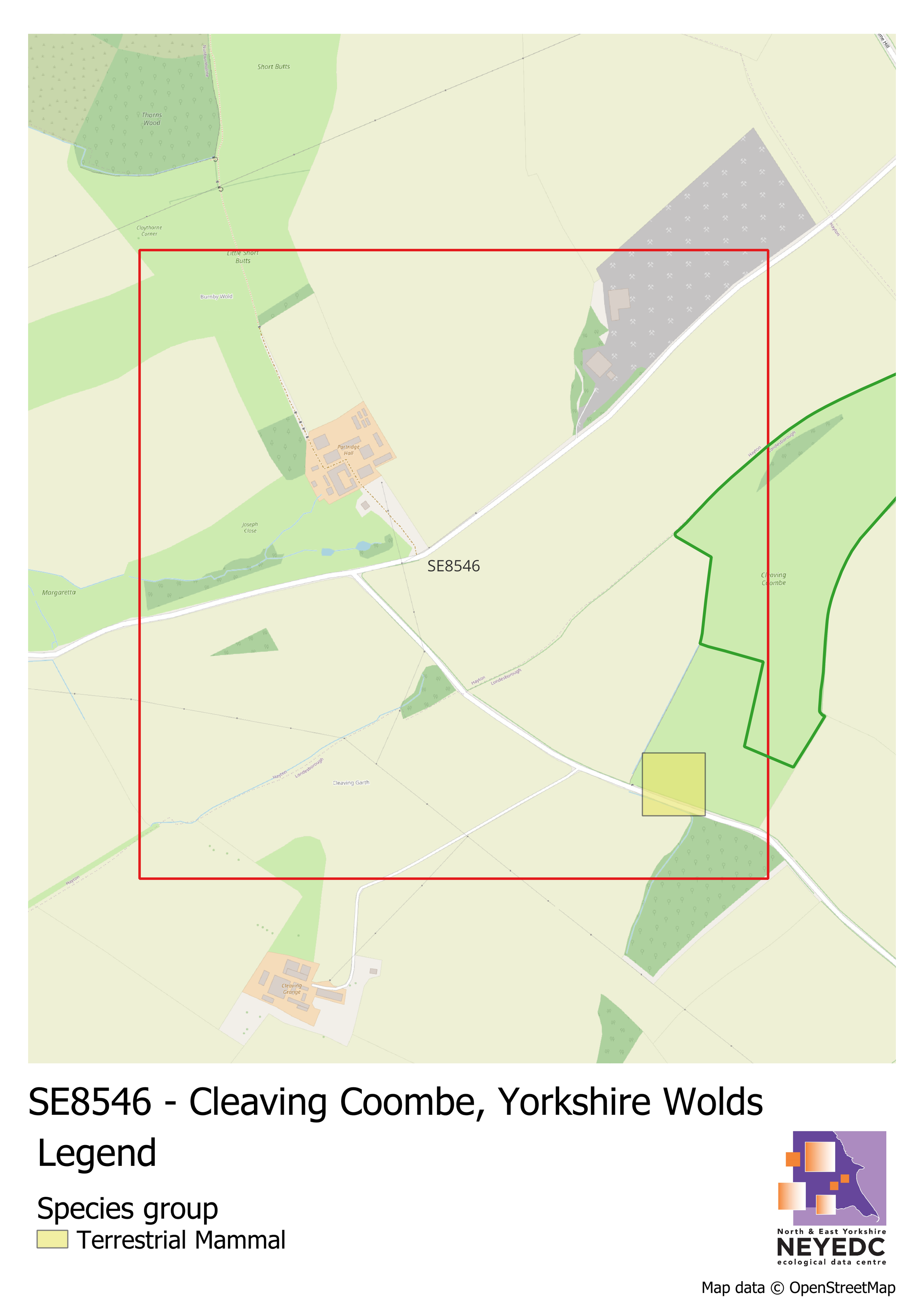
SE8546 is located about 1.8km east of the village of Burnby in East Yorkshire. The main feature of this square is that it contains part of Cleaving Coombe, a dry, steep-sided valley typical of the Yorkshire Wolds. The site is also designated as a Local Wildlife Site (Cleaving Combe) for its neutral and calcareous grassland. The valley itself is open access land which can be accessed by a gate at the head of the valley. Despite this, this grid square only has 1 record associated with it in our database, of a Stoat, whilst the neighbouring square which contains the majority of the site contains 274 records. The site appears particularly good for flowering plants and insects. The rest of the grid square contains a mixture of other habitats, including small patches of woodland, becks/streams, and arable land.
Whilst there are many sources of biological records, including on the likes of NBN Atlas and recording platforms like iRecord, as well as through organisations like BTO or BSBI, it should be noted that LERCs do not always have access to these records for local decision making, or cannot use them due to incorrect licensing, poor resolution, lack of verification, or other reasons. This series is intended to highlight areas where we have fewer records, forming gaps in our coverage. If you have records - particularly linked to specific sites or species groups - that we may not have access to, we’d love to hear from you!