NEYEDC's Data Delivery: The work behind the scenes
This is the second of a short blog series that looks at the core functions of a Local Environmental Records Centre: our role in providing clear, un-biased ecological information on sites, species and habitats. This series will look at the work completed by NEYEDC staff behind the scenes to ensure that our databases are as robust as possible, different ways NEYEDC delivers data, how we support decision making all the way from developments at a local site, to national strategy and novel research.
Data: it’s in the name!
As the North and East Yorkshire Ecological Data Centre, data is literally in our name – and it’s at the very core of what we do. Our mission is “...to improve and inform environmental decision making, conservation, land management and sustainable development in North and East Yorkshire through the collation, management, analysis and dissemination of biodiversity information.” This includes species data but also that for sites and habitats.
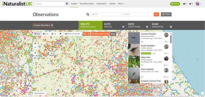
A screenshot of the iNaturalist platform covering part of the NEYEDC area - and the huge amount of data present!
There are huge amounts of ecological data that exist in the ‘data sphere’, which differ in their format, accessibility, and reliability. For example, you might be familiar with the NBN Atlas as a repository for huge amounts of species data, or iRecord and iNaturalist for making and collating species records. There are also large and well-established schemes or projects that collate records of certain species groups, for example, the UK Butterfly Monitoring Scheme (UKBMS), and societies such as the Yorkshire Naturalists Union who have a long history of data collection and local natural history expertise. Individuals may also have large amounts of data that they’ve collected themselves over time, at particular sites or of particular species groups. The government and public bodies also collect and host huge amounts of data through their own obligations and projects, such as datasets on the Natural England Open Data Geoportal, which frequently include habitat and site data at a national scale.
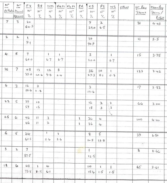
Example of a paper dataset sent to NEYEDC from an individual recorder.
With so much data ‘out there’, how do we choose what’s relevant for us? Obviously, the first consideration is a spatial one – is it in our LERC area? Another key consideration is the licensing attached to the data – do we have permission to use it for our ecological data searches and other data provisions? We might also discern which data to obtain based on how old the data is, its provenance, and whether it is verified; just some of the ways we work to ensure the data we hold is robust. We might also consider the format of the data we obtain. For example, hundreds of thousands of species records from a long-running national project may be quite difficult to interpret for a data user. Instead, we might look at how we can instead use it in another format as a data product for example, an alert layer.
Currently, we hold over 1,211,469 species records in our reporting database, 1,094,861 of which are Live. We hold information on 1,284 Local Wildlife Sites across four systems and are involved in the survey programme of 1,084 of these.
Species
Species make up the main bulk of our ‘data in’. These species records can be site-based, of a single species or species/taxonomic group, relating to a specific project or development, or casual records. Species records are sent to us (or obtained) from a huge range of sources, which includes individuals who collect records for personal interest, professionals in the ecology sector (such as ecological consultants), naturalists and local experts, public bodies, online schemes/platforms, and local groups.
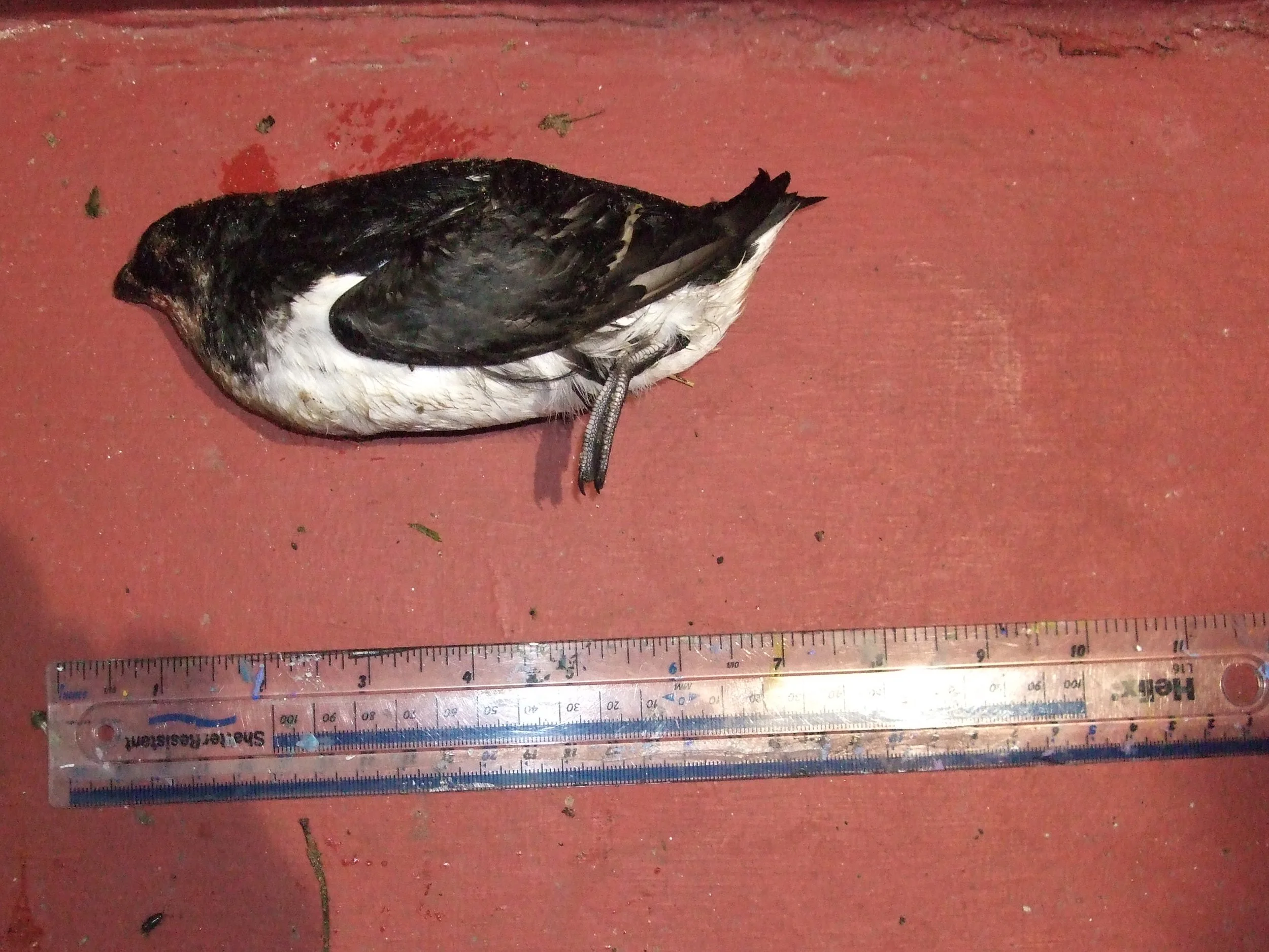
Verification photo provided to NEYEDC of a Little Auk (Ross Andrew) for a single record submission.
Our process involves taking the data in its raw form and preparing it for our database, which includes validation and verification procedures to ensure that the record is accurate and robust. These include checking spatial information to ensure that provided grid references are accurate and align with site name/location information, checking that dates have been provided, ensuring the record is in our area, determining whether the species recorded is likely to occur in our area at the stated time of year, and assessing the Verification Level of the record as provided to us (is it known to be correct, considered correct, plausible?). Sometimes, we may need to query the recorder for photographic or video evidence or provide the record to external experts for verification. As well as the standard ‘what, where, when, who’, we are also able to preserve additional information provided to us in the form of comments and additional fields which help capture the data in its fullest form. Records are then organised into distinct datasets and modules and catalogued to be added to our database, where they can be accessed for local decision-making. Our database is not static; instead, it is changing all the time in line with new data we obtain, changes to existing data, and the wishes and permissions of the data owners who have provided their data to us. Management of the species database is an ongoing process that goes beyond the preparation and input of new data.
In our current reporting database, we have 1,094,861 live records, 203,938 of which are of protected and priority species and 341,975 dated within the last 10 years.
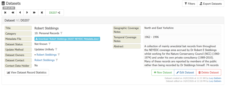
Screenshot of a dataset in NEYEDC’s database.
Sites
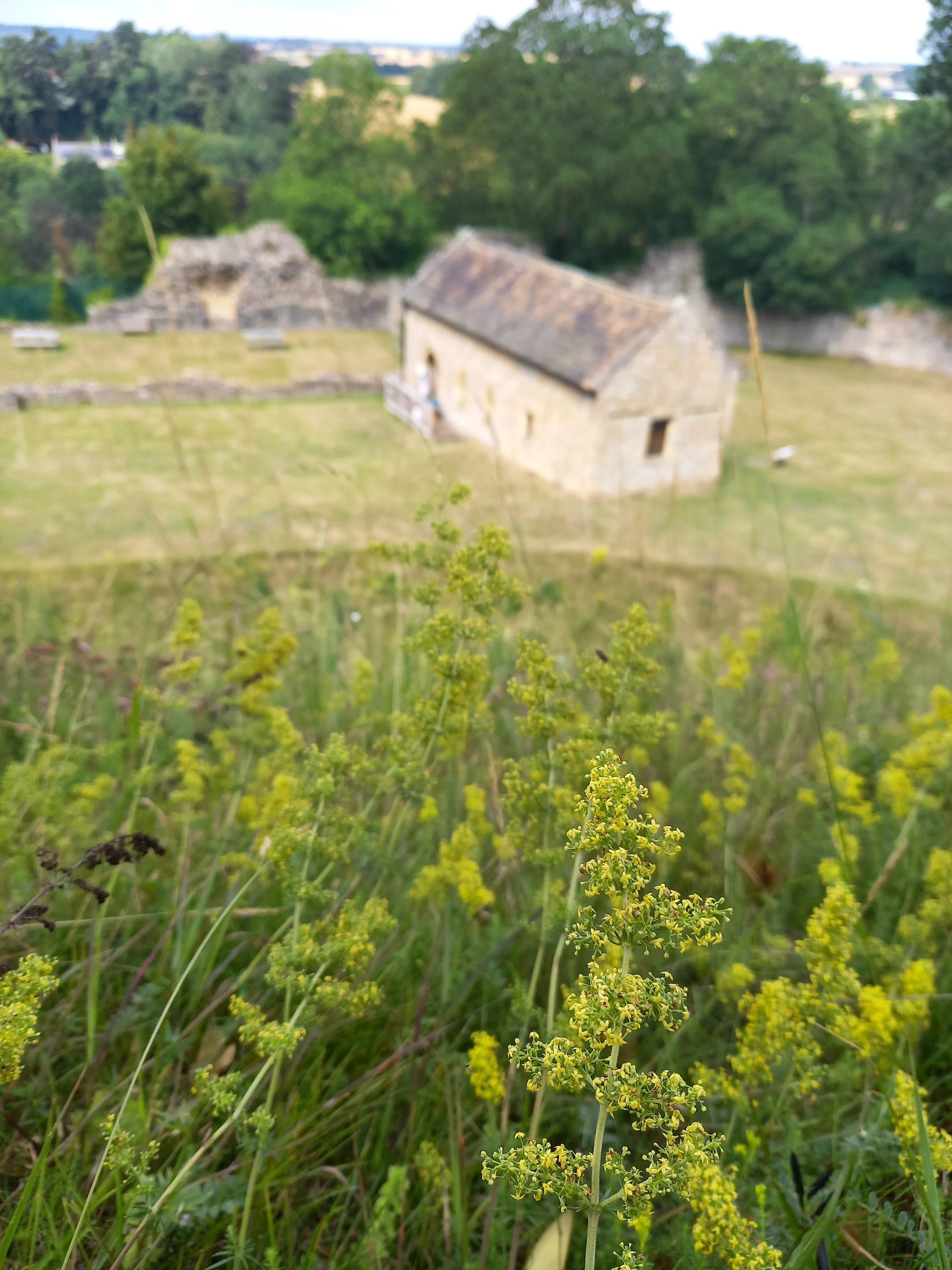
The Motte at Pickering Castle SINC site, surveyed in 2025.
Sites are also an important element of our data holdings. We are involved in the administration of the North Yorkshire SINC and the East Yorkshire Local Wildlife Site (LWS) systems, together with the respective panels that oversee them. Our role focuses on the rolling re-survey programme of some 1,084 sites, which we achieve with a team of surveyors and a dedicated NEYEDC LWS Officer to manage its administration, obtain landowner permissions, collate survey data (habitat data and associated species lists), digitise the data from paper to GIS format, maintain accurate site boundaries, and score the sites. We present these sites at panel meetings, at which stage they are discussed and given a status. Together, these represent 1,084 sites across our area. Of 300 total East Yorkshire LWS, 214 are designated, 42 are candidate, and 44 historic. Of 784 North Yorkshire SINC sites, 685 are ratified (designated), 44 are candidate, and 55 are pre-existing (unsurveyed). We hold their site boundaries, but also their designation and reason for designation, species lists, decision dates, and surveyor, amongst other information, on GIS layers and within our species database.
As Local Wildlife Sites are a material consideration in planning, this data is integral to informing local decision making and forms a key part of the data we return as standard as part of our ecological data search service.
Beyond the local scale, we also obtain, update and disseminate site boundaries for national and international sites, such as Sites of Special Scientific Interest (SSSIs), SACs (Special Areas for Conservation), SPAs (Special Protection Areas), and National Nature Reserves (NNR).
Habitats
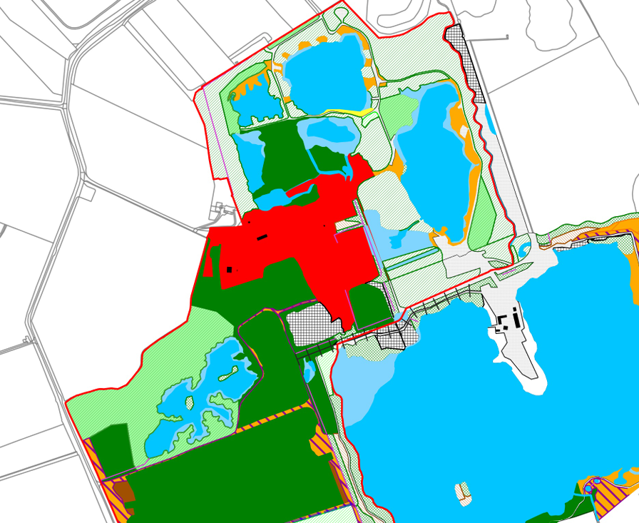
Section of a digitised habitat map produced for a SINC site in North Yorkshire.
Habitats make up the final piece of our ‘data in’ picture. The majority of NEYEDC’s habitat data comes from Local Wildlife Site surveys, which are completed by botanical surveyors in UKHab format. Illustrated using pen and paper mapping in the field, habitat polygons are then digitised to OS Mastermap in GIS by our LWS Officer for inclusion in a habitats GIS layer, ensuring there are no polygon overlaps or incorrect geometries, and that they match the correct site boundaries. Habitat types and their associated species assemblages are used in determining the criteria and score under which a local site qualifies, but the data is in itself a valuable addition to our database as a tool for data users to identify conservation priorities, monitor change in sites, inform management decisions, determine site/habitat connectivity or corridors, model species distributions etc. Habitat data may also come into us via local projects or monitoring, for example, as a result of habitat creation or restoration schemes. As with national and international sites, we also obtain and disseminate key habitat layers such as the Ancient Woodland Inventory and the Priority Habitats Inventory from Natural England, which act as the cornerstone of our habitat provision for ecological data searches.
We are in the early stages of improving our habitats holdings, one of the aims of our current 5-year strategy. The first stages of this process involves considering how we create a habitat data system that allows us to integrate data from a wide variety of sources, translate between classification systems (e.g. UKHab, NVC), and the best way for this to be stored and queried so we can create useful habitat data products.
Generating our own data
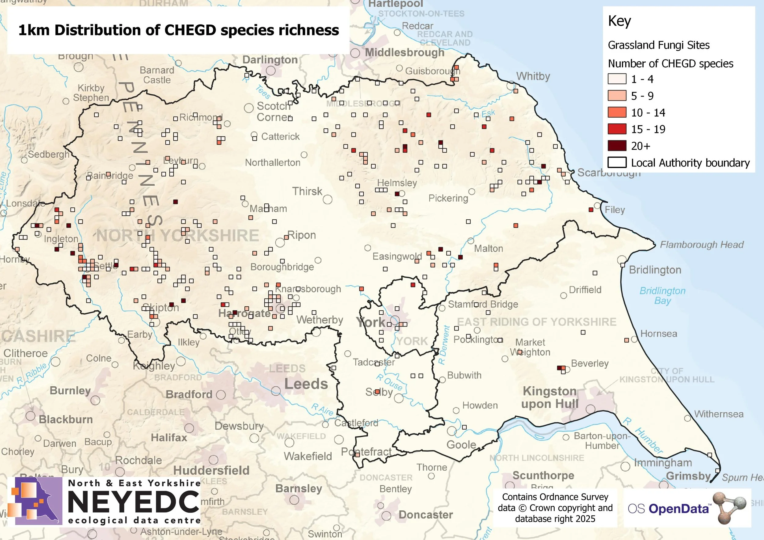
Map showing a 1km distribution of CHEGD fungi species generated from data collected as part of NEYEDC’s Waxcaps project.
Ecological data isn’t just something we obtain externally. NEYEDC is involved in or leads a range of projects that involve the capture of ecological data in various forms. Our ‘Waxcaps: the jewels in Yorkshire’s grasslands’ project ran from 2022 – 2025 with funding from the Yorkshire Water Biodiversity Enhancement Fund. It identified, and subsequently mapped to a data layer, a large number of previously unknown sites of importance for grassland fungi around North and East Yorkshire – some of which were of national significance. As well as the identification of important sites, the project also generated huge numbers of records of CHEGD grassland fungi, which have historically been highly under-recorded. The data products created during the project will become available to a wide range of data users to inform local decision-making for low-input grasslands, which are a rare habitat. We have also hosted volunteers over a number of years to learn to trap and record moths, which began with the Centre for Ecology and Hydrology’s DECIDE Project. We provided volunteers with their own bucket-style LED moth traps, which has generated over 1,000 records and counting.
We have also been involved as a partner in large-scale projects such as The Wild Watch, Nidderdale’s biggest ever systematic wildlife survey where we planned surveys, collated records, and produced mapping outputs, and in long-running survey projects such as the North Yorkshire Turtle Dove Project.
Together, these data make up the huge range of ecological information that we collate, manage, and disseminate. By following exact processes and procedures throughout every stage of the preparation, transformation and storage of data, we work to ensure that the information we go on to share is as reliable as possible. Our next instalment of this series will look at what informing local decision making using this data actually looks like.