NEYEDC’s Data Delivery: A different kind of milestone…
This is the first of a short blog series that looks at the core functions of a Local Environmental Records Centre: our role in providing clear, un-biased ecological information on sites, species and habitats. This series will look at the work completed by NEYEDC staff behind the scenes to ensure that our databases are as robust as possible, different ways NEYEDC delivers data, how we support decision making all the way from developments at a local site, to national strategy and novel research.
At the end of March 2026 NEYEDC reached a different kind of milestone – logging its 10,000th data search since moving to Cofnod’s ‘ORCA’ (Online Records Centre Administration) system in April 2012. This led staff to take a walk down memory lane and look back at how data delivery at NEYEDC has changed over the past 25 years!
The early days – fax and post!
NEYEDC began its data search service in 2000, two years after its governing charitable trust had been set up and gathering sites, species and habitat information had begun in earnest. Two to three ecological data requests were received each week, occasionally by email, but more often by post and fax! Handwritten notes of the information required and hand-drawn maps of the site in question were commonplace.
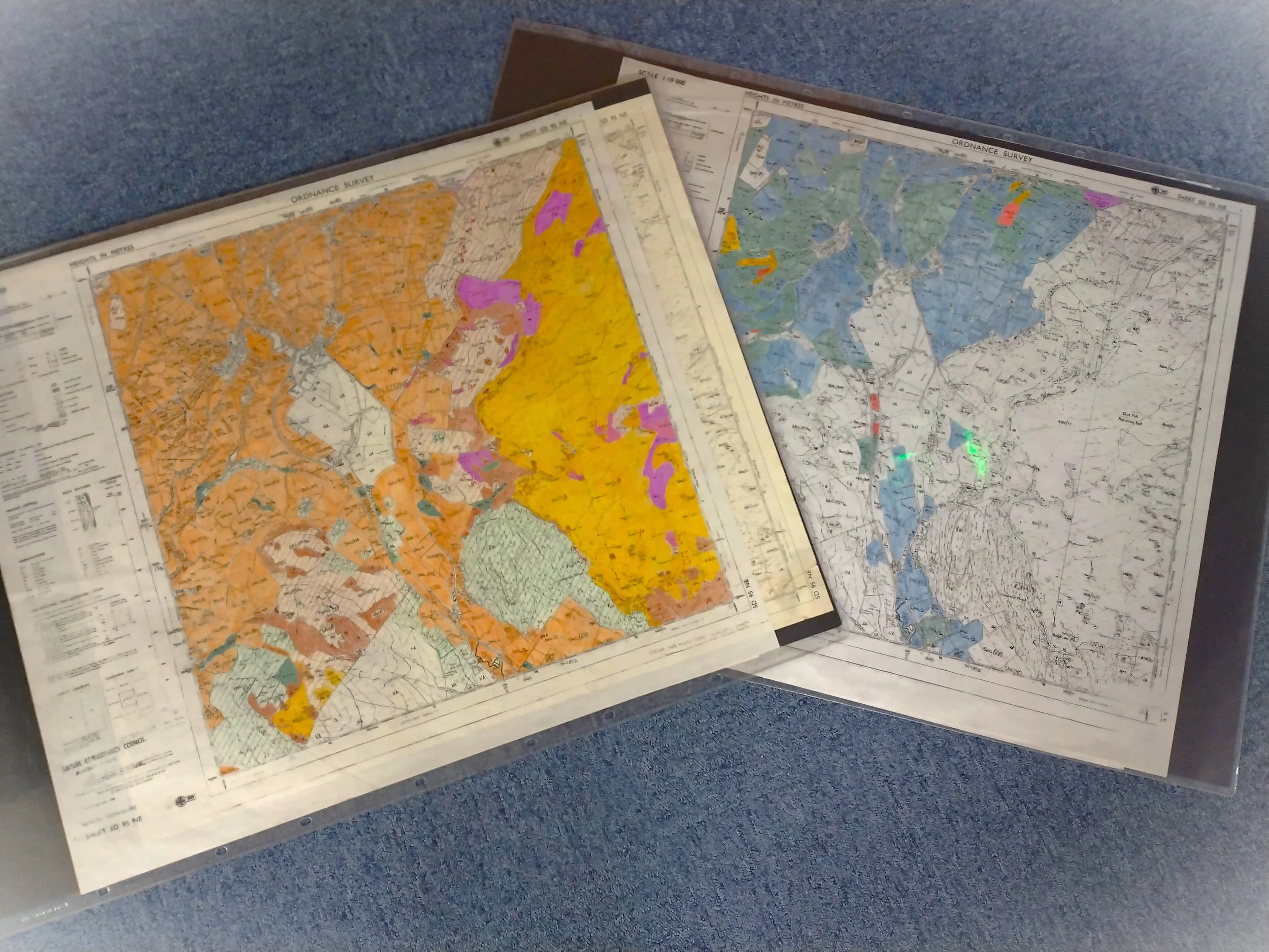
A details document, species list and sites and habitat maps for each request were compiled by manually searching the Geographic Information System (GIS) for sites, the species database and looking at original paper Phase 1 habitat maps from the 1980’s and their boxes of target note cards to identify key habitats (these Phase 1 were the pre-cursor to the national habitat inventories and the Priority Habitat Inventory that can now be downloaded from Natural England’s Open Data Portal).
NEYEDC still has copies of the original Phase 1 maps and their condition assessment, which are occasionally still referred to!
Dedicated staff
By 2008, enough data searches were being received, and Mark’s job role as Ecological Data Officer had expanded, that a part-time dedicated data search officer was required. Wendy joined NEYEDC in 2008, working 2-3 days per week until her retirement in 2021. By now the data search process was using more templates and the species data was queried using an internal system that also pulled down records from NBN Atlas (or NBN Gateway as it was called then) using web-services, which was new technology at the time.
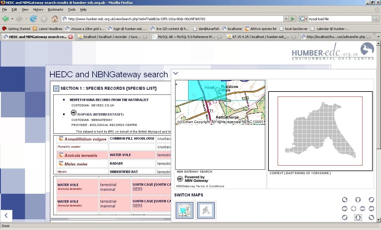
All data searches were received by email, with client’s completing a Word document form for their request. Even though the numbers of data searches were increasing, they were still completed and returned one at a time. It was during this time that NEYEDC started using the ORCA database to hold client’s contact details and log the searches – moving away from a simple Excel spreadsheet.
First steps of automation
By 2016 the number of ecological data requests being received meant that the data search system had to be streamlined with the introduction of batch processing. NEYEDC contracted ex-LERC employee Matt Davies of Maplango to create a GIS-based data search system that would enable batch processing of maps and species lists – a big shift from completing data searches one at a time.
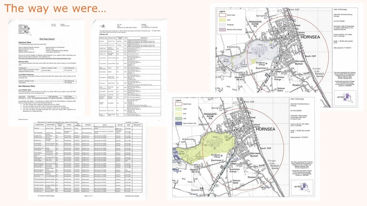
However, details document and formatting of the species list and species records documents were still completed by hand and the client would still receive at least five documents per data search.
My LERC and eMapper
The GIS-based batch processing of data searches was used for seven years. During the last two of these years, NEYEDC was preparing for a switch to using Cofnod’s fully automated eMapper system for data delivery. However, there was the small matter of moving a 20-year old Recorder 6 database into the Orca database – no mean feat! To free up more time to work on learning a new database that would be able to deliver sites, species and habitat data in one, NEYEDC first streamlined the receipt of data searches through introducing MyLERC in April 2022. Gone were emails, quotes and data request forms that were manually entered into the Orca administration system as MyLERC automatically populated Orca with required information, including site boundaries, and provided a quote to the client - just the searches themselves continued to be completed using GIS.
By April 2023 NEYEDC was in a position to launch the delivery of data searches using eMapper, providing clients with a one-stop product for sites, species and habitats that could be tailored through a series of filters to meet their needs. The client can now filter and download their data search results in a variety of formats, creation of bespoke maps, and explore their records via interactive online mapping. Crucially, this system provides a spatial representation of the species records, helping the client make better informed decisions.
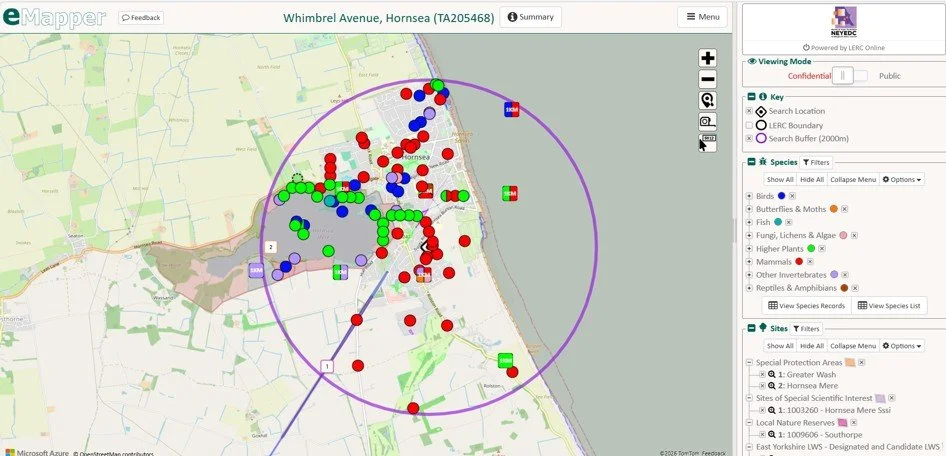
Spot the difference! This is the same data search as the one above, but using eMapper for data delivery.
And it doesn’t stop there! NEYEDC is continually adding to its sites, species and habitats databases, making available both existing datasets and creating new datasets that will further support clients in their decision-making. In 2026 NEYEDC will start to highlight to clients the species of importance identified in the Hull and East Yorkshire Local Nature Recovery Strategy and North Yorkshire and York Local Nature Recovery Strategy (LNRS) and Yorkshire Species of Concern (YSC) that underpin the State of Yorkshire’s Nature Report 2024 as well as a distribution map of 1km squares that are important for grassland fungi. Our new data search system has made it easier than ever to deliver new products to our clients, increasing the accessibility, ease of interpretation, and breadth of information we can provide to support decision-making.
Look out for the next blog in this series that will explain how NEYEDC’s databases are used in local decision-making.