
Data Diaries #8 - Strandline recording on the East Yorkshire coast
Data is at the core of what we do as a Local Environmental Records Centre. This series shines a light on the breadth and variety of the records we receive and how we deal with them.
Despite the North and East Yorkshire area having such a large coastline, marine and coastal data is an area of biological recording which is often under-represented, and this is the case in our reporting database. Happily, we have now started to receive some valuable strandline data from the East Yorkshire coast which will now help to fill these gaps.

Velvet Swimming Crab, one of the species recorded (Paula Lightfoot)
In April 2025 we received the first spreadsheet of intertidal data from local recorder Keith Clarkson, collected via regular walks along the strandline of the beach at Hunmanby Gap, East Yorkshire, between 2023 and 2024. In total, the data comprised of 646 records of various species that had been washed up on the strandline along a transect that the recorder walked, either live-stranded or dead. This included everything from seaweeds and hydrozoans to marine mammals and birds. Earlier this year, we received data for 2025, which suggests an impressive number of new records and a high diversity of species being recorded. This data is still being prepared for input into our database, but totals over 600 records up until April 2025 – an impressive number!
As well as the standard information making up a biological record, Keith also collected and provided us with additional information such as weather conditions on the day of the transect walk and comments about the strandline appearance in general to provide context to the records made. This is a helpful addition which we can transcribe into Comments for our data users to access when records appear in searches.
This data fills an interesting gap in recording, even considering existing marine recording schemes and initiatives. Often, recording focuses on the rocky shore environment or recording of marine mammals from shore watches. Whilst there is some overlap between these types of surveys and the species data we received from Keith (i.e. stranded marine mammals or well-known rockpool species such as crabs or small fish), strandline data encompasses many other species or species groups, including those that utilise sandy habitats such as marine worms and bivalves, as well as limpets, barnacles, krill, and larger fish species. In addition, whilst many of the species recorded on the strandline are dead, many within this dataset are noted as being stranded alive and these events tend to occur after weather events that suggest these species are present locally and not simply washing into the area from other places. This could represent an intriguing and scientifically valuable modern-day baseline for marine species locally and provide an alternative to high-cost inshore and offshore sampling methods that are traditionally used to survey our shoreline and seas.
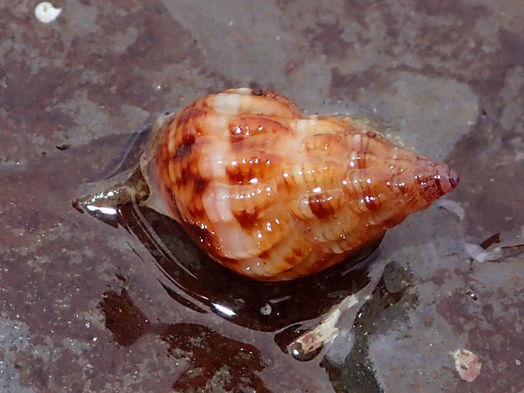
Thick-lipped Dog Whelk (Paula Lightfoot). Many of the species recorded in this dataset are molluscs and bivalves that have washed up on the sand, including mussels, tellins, whelks, periwinkles, and other species.
The generous sharing of this data with us means that we are able to hold and disseminate a wider range of marine species data than previously. With the introduction of Local Nature Recovery Strategies and the move towards a species’ ‘importance’ not only being based on designations given to them (such as protected and priority species) and instead to rare species or good indicator species for an environment, this new data may become ever more valuable in the future. Research suggests that benthic marine species groups such as annelids, echinoderms, cnidarians, molluscs, crustaceans, and demersal fishes can be good indicators of the health of marine ecosystems and for monitoring change (1), many of which are reflected in our new dataset.
In the coming months, Keith hopes to analyse this data to make comparisons between modern-day findings and historical data from the Scarborough area.
Despite over 25 years operating as the region’s Local Environmental Records Centre, there is always a new species set, recording method or project to represent in our database, and we are thrilled to have this up-to-date set of intertidal records to disseminate.
(1) Wanhong Han , Qingxi Han. (2024). Macrobenthic indicator species: From concept to practical applications in marine ecology. Global Ecology and Conservation. 55. [Online]. Available at: https://www.sciencedirect.com/science/article/pii/S2351989424004669 [Accessed 17 February 2026].
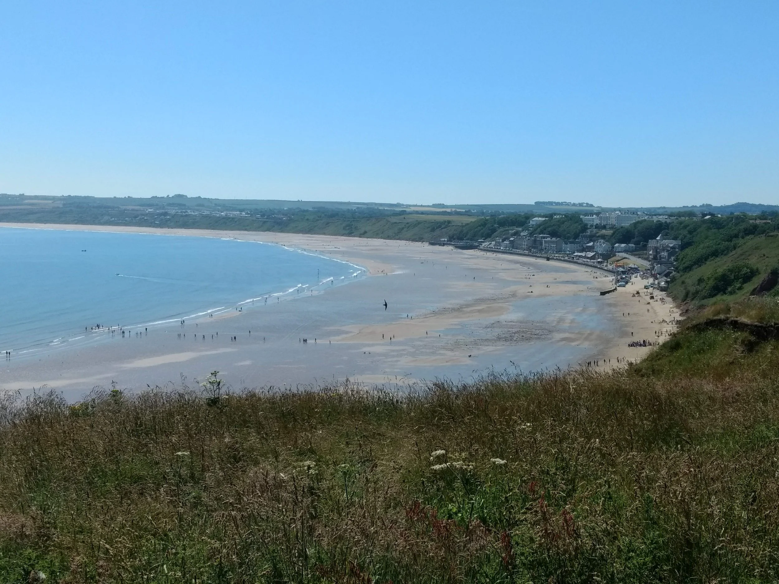
One of Yorkshire’s sandy beaches, this one at Filey Bay (Clare Langrick).