NEYEDC's Data Delivery: Informing local decisions
This is the third in a short blog series that looks at the core functions of a Local Environmental Records Centre: our role in providing clear, un-biased ecological information on sites, species and habitats. This series will look at the work completed by NEYEDC staff behind the scenes to ensure that our databases are as robust as possible, different ways NEYEDC delivers data, how we support decision making all the way from developments at a local site, to national strategy and novel research.
In planning
The planning process in North and East Yorkshire (including York and Hull) is largely the same as in the rest of the UK, governed by the Town and Country Planning Act 1990, the Planning and Compulsory Purchase Act 2004, the Environment Act 2021, the National Planning Policy Framework, and other regulations. In all locations, biodiversity is a ‘material consideration’ in planning, meaning it must be considered. The weight of the material consideration depends on the significance of the affected habitat or species in a national or county-wide context, and the severity of any impact or harm that might be identified.
In order to determine what consideration needs to be given, an applicant or developer will work with a planning ecologist, who is responsible for sourcing relevant data and ultimately making decisions about the next steps in the application as regards biodiversity and the environment. This is often at the pre-planning stage and is where we come in!
As part of our Ecological Data Search Service, we provide approximately 900 sets of data search results to clients (mainly ecologists) each year, the majority of which (75%+) relate to planning or pre-planning applications. Consultants make their requests to us by selecting from a suite of pre-set packages which cover different elements of our database. Usually, this includes species, sites, and habitats data within a 1 or 2km buffer of the site or point of development.
A standard search
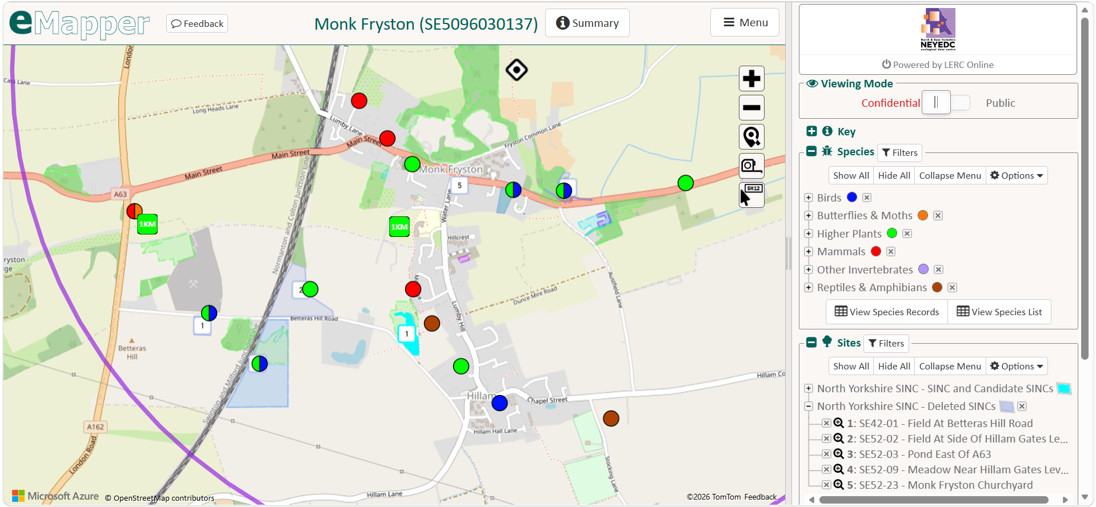
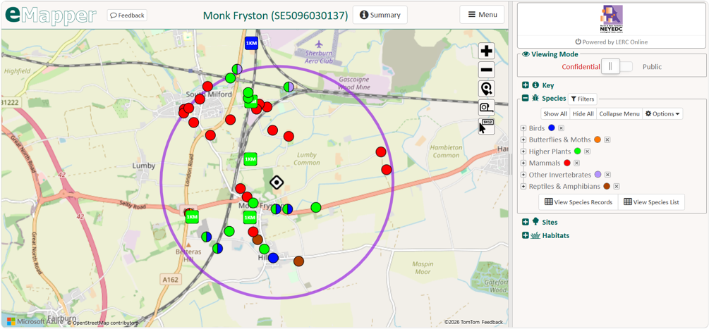
The images here show the output of an ecological data search. eMapper, which delivers the search, returns the data via an interactive map portal where the ecologist can view, explore, and filter the data, as well as download it in various formats that they might find useful.
Species

Great Crested Newt, a protected species.
Species records are always returned as part of a standard search. Usually these include protected, priority, and INNS (invasive and non-native species) only, but occasionally we are asked to return all species records in the area. Protected species include Badger, all species of bat, Great Crested Newt, Otter, Water Vole and Barn Owl, and these are a material consideration in planning. On the map screenshots above, the species are shown as circles, colour-coded based on that record’s species group, but these can also be filtered by specific species. Some records, shown as squares, are of a lower resolution grid reference, for example, 1km, and are included but represented slightly differently on the map, as that species record could, theoretically, have been recorded anywhere within that 1km square. These are less helpful than records where their location is recorded more finely, particularly when considering smaller-scale developments and these typical 1-2km buffered searches. At a local level, high-resolution records are particularly important for this reason.
Sites
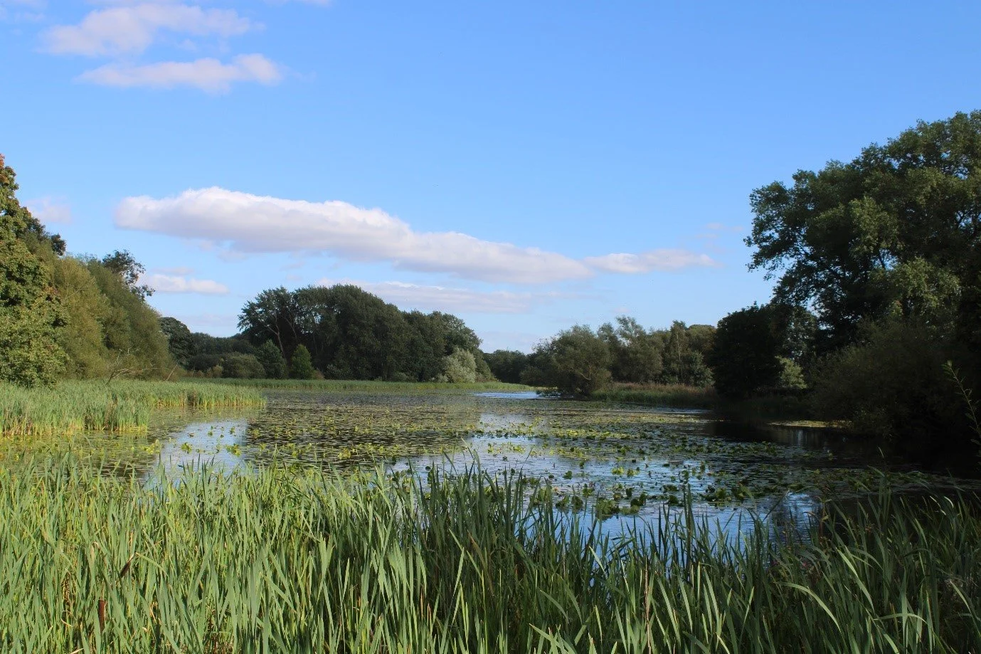
We return data on non-statutory and statutory sites as part of our standard data search. This includes international (Ramsar, Special Protection Areas, Special Areas of Conservation), national (Sites of Special Scientific Interest, Local Nature Reserves, National Nature Reserves) and local sites (Local Wildlife Sites, Yorkshire Wildlife Trust Reserves etc.). For national and international sites, we return the boundaries of these areas as provided by Natural England. For local sites, as we are involved in their designation and survey process for North Yorkshire and York Sites of Importance for Nature Conservation (SINCs) and East Yorkshire Local Wildlife Site (LWS) systems, we are able to provide more specific information, including their reason for designation and short citations for each site, alongside their boundaries. We also share simple boundaries for Hull’s Sites of Nature Conservation Importance (SNCI) where we are not involved in the survey and designation process.
Habitats
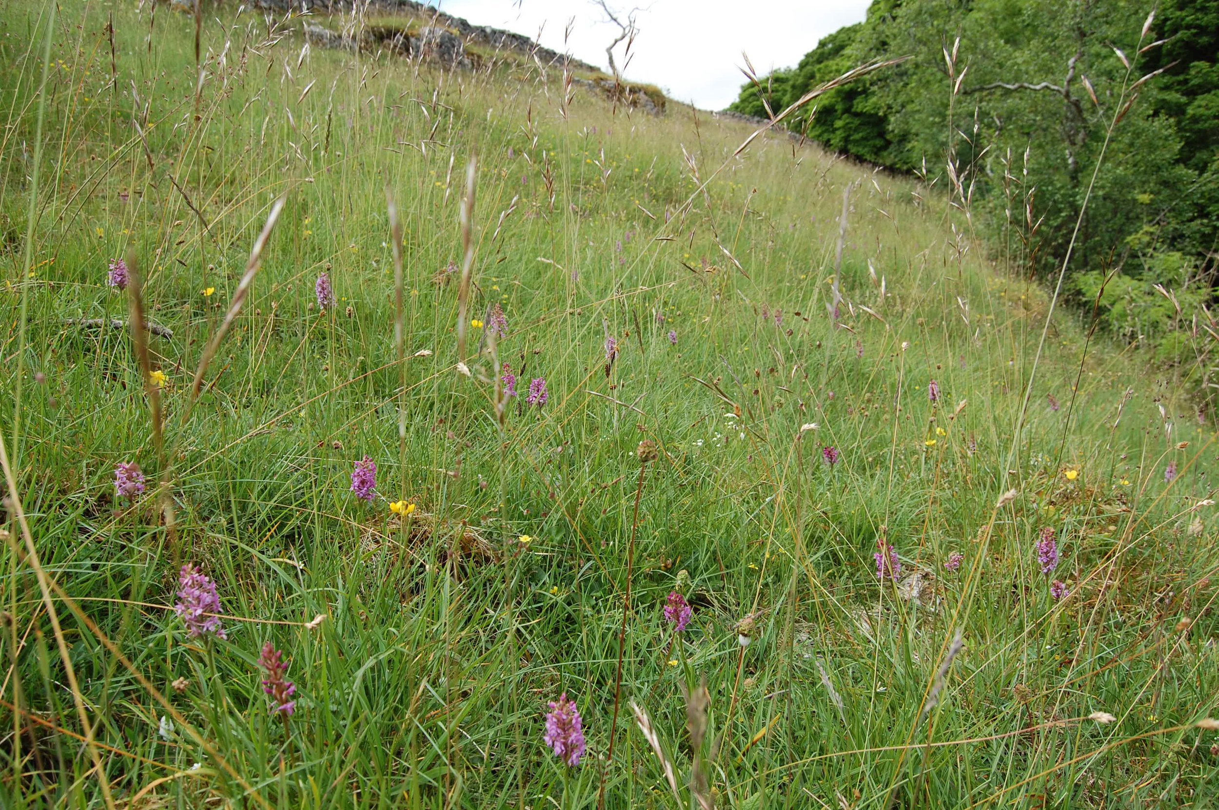
Species-rich grassland, recognised as a Priority Habitat.
Priority habitats are also a material consideration in planning. As part of our habitats provision, we provide this key Natural England layer as well as additional layers including the Ancient Woodland Inventory and Ancient Tree Inventory. We also hold habitat data from surveys of our local wildlife sites; however this isn’t routinely disseminated through this route.
Together, this information helps an ecologist make informed decisions about whether the development site requires further survey, if there are any risks or potential impacts on biodiversity associated with the development, and if the site is suitable.
Commercial licences
We also provide this data in slightly different ways for larger-scale developments, nationally significant infrastructure projects (NSIPs), and developments that might involve lots of organisations, consultants, or stakeholders. In these cases, we offer a commercial data licence, which often includes large sections of our database to cover wide geographic areas for a specific project. We also update these licences at no added cost after 6 months, which ensures that we’re always providing our most up-to-date data to inform important decisions.
Biodiversity data in planning - is it always used?
Biodiversity is a material consideration in planning, meaning it must be considered as part of the planning process – it isn’t optional! However, research conducted by ALERC (Association of Local Environmental Records Centres) has shown that ecological evidence is absent in the majority of planning applications.
ALERC worked alongside 35 English LERCs to record the number of ecological data searches being completed each year in their area vs the number of planning applications being undertaken in the same area. Unfortunately, the average percentage of applications in England informed by a LERC data search for the past five years has consistently been below 10%, and the year-on-year increase in this is very small. Whilst NEYEDC provides four out of six of our local planning authorities with access to our data and related data services as part of annual agreements, the report also found that 66% of local authorities do not have access to their LERC’s evidence base.
These are concerning statistics and illustrate the importance of LERCs and our work, as well as raising questions about how these figures can be improved.
Decision-making for conservation
Planning isn’t the only area that our data informs. We also support decision making in other contexts, including conservation, land management, and habitat restoration. We often provide this via non-commercial data licenses, which we are able to offer at a reduced cost thanks to our local authority partners to support these measures in our area. Examples of this include licenses for tree planting schemes by White Rose Forest and restoration of Yorkshire Wildlife Trust-owned land.
Hopefully the above gives a flavour of the range of instances in which our data goes on to inform decisions locally. A core aspect of our work, we’re always working to improve our data provision and play our part in ensuring we have the best evidence possible to support them.